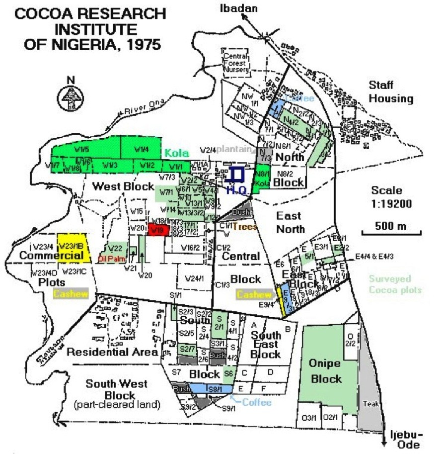
Cocoa areas in which the Black Pod Project work was carried
out are shown in light green.
Major studies were in Blocks E5/1, Onipe 1/1 and S1/1.
Survey Blocks were:-
4898 tree survey of mature cocoa:
Onipe 1/1; N1/1; N3/2; N3/3; S1/1; S2/7; SW1/1; W2/2; W5/1; W6/1; W7/1;
W13;/1; W13/2; W17/1; W21; and W22.
The dominated trees survey in cocoa (50 trees per dominant):
N4/1; S6/1; W7/1; W12/1; W14/1; W17/1.
Other surveys were of cocoa under varying shade and of
other tree crops, plus forest trees being felled in the Central Block:
E2/2 - Cocoa; E9/4 - Cashew; N4/5 - Coffee under Kola; N7/3 - Plantain
shade over young Cocoa; S2/1 - Cocoa under Plantain shade; S8/1 &
2A - Coffee - unshaded, with a closed canopy; W1/1 - Kola; W10/1 -
Cocoa under forest shade; W20 - Cocoa under forest shade; W22 - Oil
Palm and interspaced Cocoa; W23 - Cashew.
Most of the blank areas were, at that time, anything from partly
cleared land to a state close to primary forest, with some remaining
climax trees.