![]()
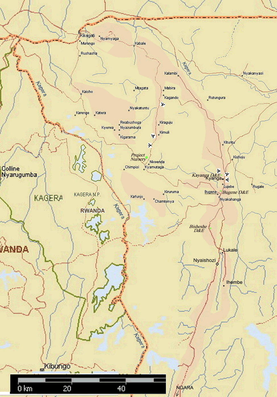
The Bananas of Upland East Africa - General Map of Karagwe District, Kagera Region of Tanzania |
Darker areas indicate higher land, rising to 1719 m (5640 feet) asl, e.g. at the Nyakahanga water tank; with central valley bottoms at around 1402 m (4600 feet) at Nyaishozi and Lukale, and the eastern Kagera River around 1210 m (3970 feet) asl, with the western swamps and lakes at ca 1300 m (4265 feet) asl.
Underlined locations, the vista points and all project sites have linked views.
On the eastern ridge tops there were quite elderly coffee/banana shambas, one visited at Kishao had coffee bushes dating back to 1929. The bananas in such areas were mostly in poor condition, as with newer shambas along the east-west ridge towards Nkwenda, where the soil became distinctly more sandy. Resettlement areas, such as the Mabire valley, with inmigrants from the Bukoba area, and Nkwenda with a number of Tutsi families formerly from Rwanda, and shambas around 15 years old, were still mostly in good condition. The poor communications with Bukoba and beyond meant that these farmers were unable to exploit the market potential for their banana crops.
 Darker areas indicate higher land, rising to 1719 m
(5640 feet) asl, e.g. at the Nyakahanga water tank; with central valley
bottoms at around 1402 m (4600 feet) at Nyaishozi and Lukale, and the
eastern Kagera River around 1210 m (3970 feet) asl, with the western
swamps and lakes at ca 1300 m (4265 feet) asl.
Darker areas indicate higher land, rising to 1719 m
(5640 feet) asl, e.g. at the Nyakahanga water tank; with central valley
bottoms at around 1402 m (4600 feet) at Nyaishozi and Lukale, and the
eastern Kagera River around 1210 m (3970 feet) asl, with the western
swamps and lakes at ca 1300 m (4265 feet) asl.
Underlined locations, the vista points and all project sites have linked views.
| ©2000 - Brian Taylor CBiol FIBiol
FRES 11, Grazingfield, Wilford, Nottingham, NG11 7FN, U.K. Visiting Academic in the Department of Life Science, University of Nottingham |