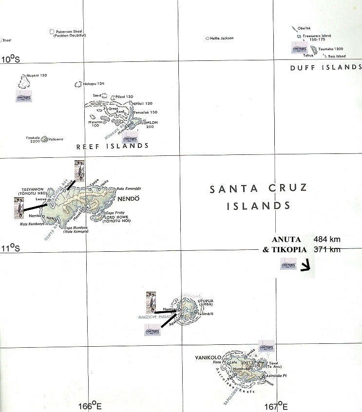
The islands of the Santa Cruz Group are perhaps the most isolated and least visited in the Southwest Pacific. Politically and administratively known as the Eastern Outer Islands, the islands lie at the extreme eastern end of the 1600 km long Solomon Archipelago. The islands, which have a total land surface of only 836 km², are scattered over a wide area of the Coral Sea (9°30' to 12°30'S and 165°30' to 170°30'E). The nearest lands are to the south, the Torres Group of islands at the northern tip of the New Hebrides, over 150 km away; 400 km to the west is San Cristobal in the main Solomons. However, the Santa Cruz group is separated from the main Solomons by the Torres trench, over 6000 m deep; apart from the isolated islands of Tikopia, Anuta and Fataka, it lies on the same submarine ridge as the New Hebrides.
Their climate has the seasonal characteristics typical of tropical islands lying in the zones of the tradewinds. Rainfall can be considerable, particularly when mountains are present as on Vanikoro. The population is approximately 9000 (1970 Census) with a predominance of Melanesians on the larger islands and Polynesians on the others. The average density is 10.8 persons per km² with variations from 1.1 on Vanikoro to 201 on Tikopia. Though recent evidence suggests that the movements of populations in the subarea have been quite extensive in the remote past, Tikopia and Anuta have remained relatively isolated, whereas cultural and commercial interchanges seem to have been continuous and active between the Santa Cruz Group, the Reef Islands and the Duff Islands.
I was fortunate to visit the majority of the islands, although I have no photographs of the famous island of Tikopia, well-loved by anthropologists, as it was a very wet day when we called there.
| Santa Cruz Islands Ndeni is the main island (area 518 km²),
with an extensive coral plateau in the western part, the remainder being
volcanic basalt rising to over 300 m. The island is densely wooded, with
a good network of rivers and creeks. The coast is mainly rocky but there
are beaches along the western parts while mangroves are common in the
bays and lagoons of the central and eastern portions of the southern
coast. The opening of a District sub-station and airfield at Graciosa
Bay in 1970 greatly improved communications. The active volcano, Tinakula, rising to over 700 m, erupted in 1971, leading to the evacuation of the single small village, used mainly by Reef islanders visiting for gardening. |
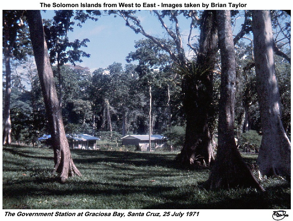 Title: The Government Station at Graciosa Bay, Santa Cruz, 25 July 1971 |
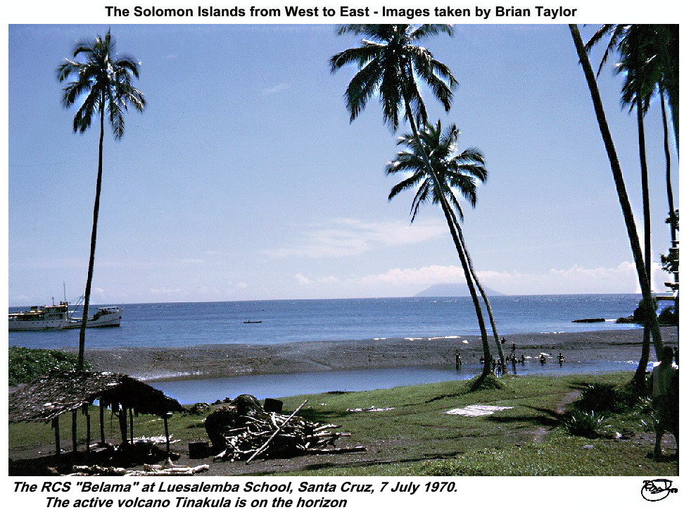 Title: The RCS "Belama" at Luesalemba School, Santa Cruz, 7 July 1970. The active volcano Tinakula on the horizon. |
|
| Reef Islands Group In 1970, the population was some 4000, with 700 being Polynesians, mainly living on the outer low-lying coral islands, such as Nupani and Nukapu. The Inner Islands are somewhat more raised, up to 20 m, coral islands with extensive shallow reef area and mangroves; these are inhabited by Melanesians. | 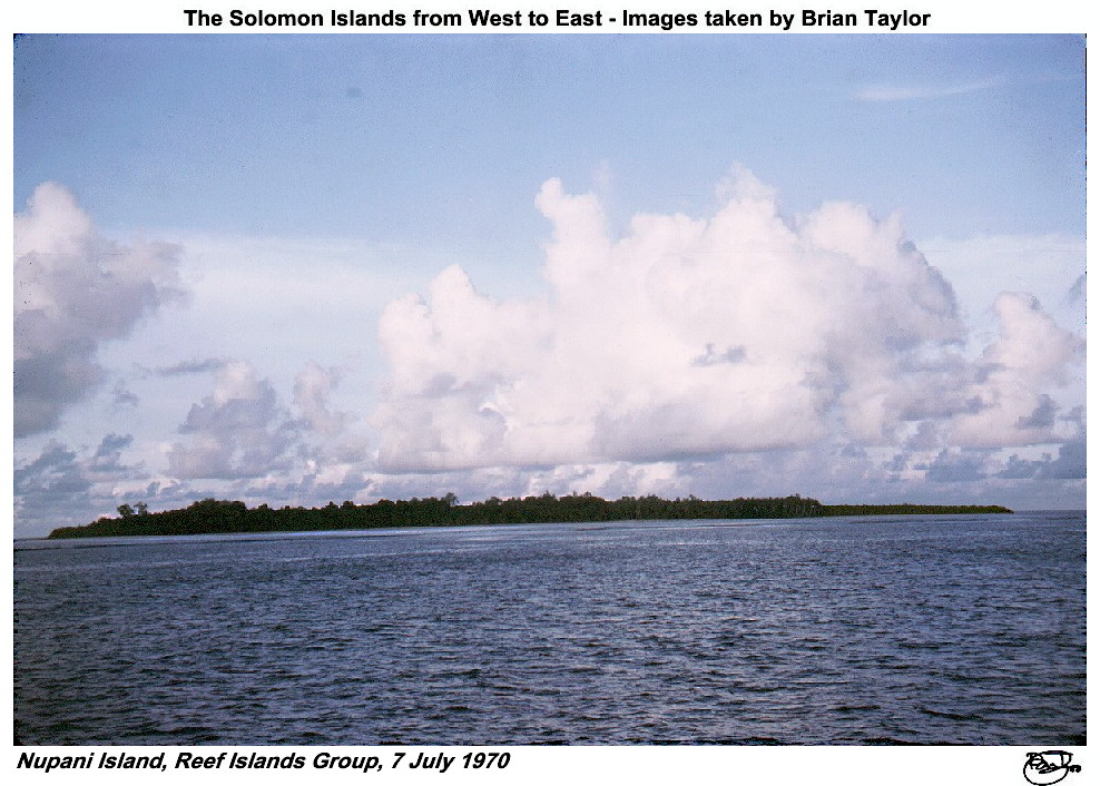 Title: Nupani Island, Reef Islands Group, 7 July 1970 |
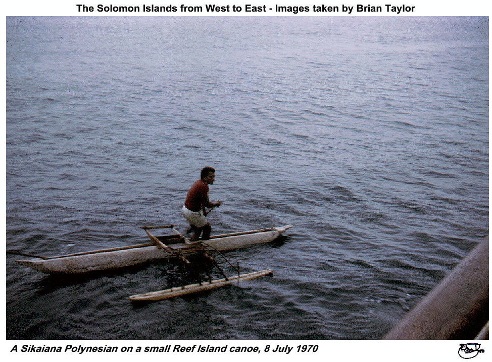 Title: A Sikaiana Polynesian on a small Reef Island canoe, 8 July 1970 |
|
| The Duff Islands Occupied by Polynesians, around 200 in 1970, this is a compact chain of small islands of volcanic origin. The main islands, Taumako, rises to around 400 m. Most of the people were living on the ancient artificial island, Tahua, some 200 m offshore within a shallow reef. There was a small village, Kahula, on the eastern side of Taumako, and one family was living on Treasurer's Island. The height of the islands means that the rainfall is quite high and there are swamps on Taumako opposite Tahua. | 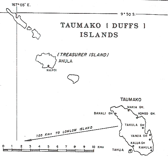 Title: The Duff Islands |
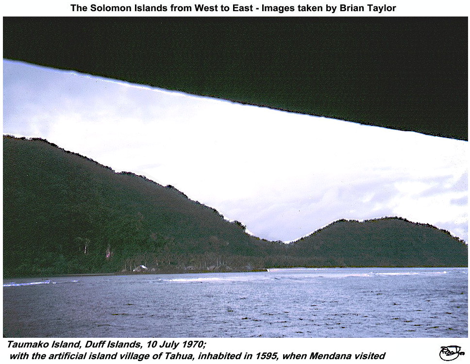 Title: Taumako Island, Duff Islands, 10 July 1970; with the artificial island village of Tahua, inhabited in 1595, when Mendana visited |
|
| Utupua This is a moderate sized island (area 78 km²) of volcanic origin, rising to 400 m, densely wooded and surrounded by an extensive coral reef. In 1970, a small Melanesian population, about 230 people, was distributed among several small villages and two larger ones, Old and New Nembao. | 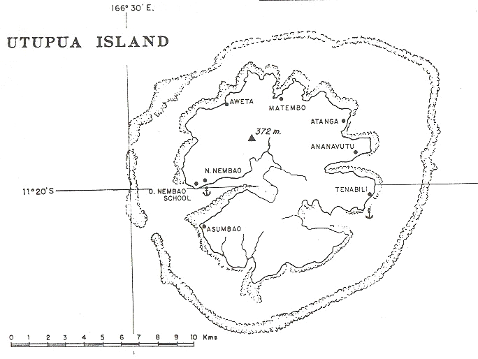 Title: Utupua Island, note the encircling reef |
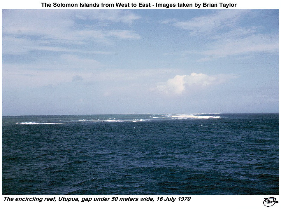 Title: The encircling reef, Utupua, gap under 50 meters wide, 16 July 1970 |
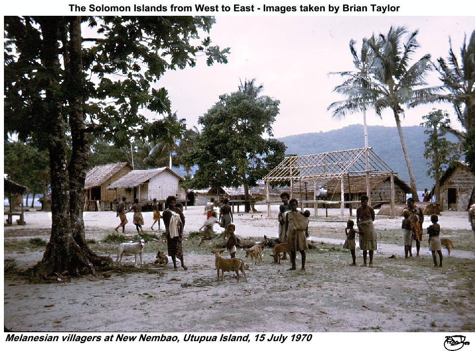 Title: Melanesian villagers at New Nembao, Utupua Island, 15 July 1970 |
| Vanikoro A moderate sized island (156 km²) of volcanic origin rising to nearly 1000 m. The height means that it is among the world's wettest places, with an average of over 5000 mm per year. It is heavily wooded and the high value Kauri Pine was subject to timber operations based at Peu but abandoned in 1965. A great part of the coast is covered in mangroves. In 1970 there was a small Melanesian village (163 people) in one large village, Buma on Tevai Island, and 3 small villages. | 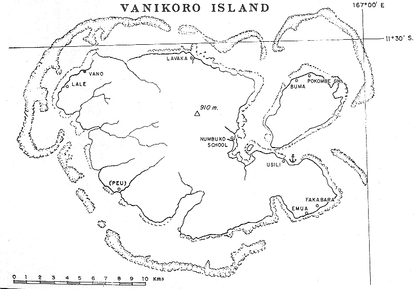 Title: Vanikoro Island |
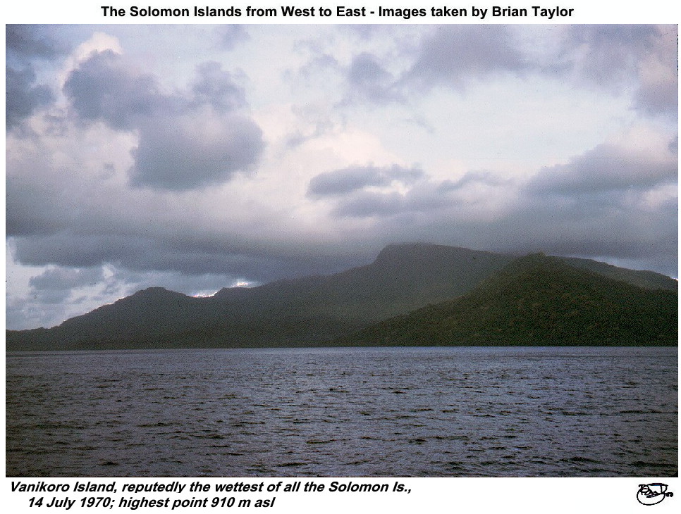 Title: Vanikoro Island, reputedly the wettest of all the Solomon Is., 14 July 1970; highest point 910 m asl. |
|
| Anuta Among the world's most isolated islands, Anuta is very small (2.6 km²) and of volcanic origin. In 1970 a population of 157 Polynesians lived in two villages on the low-lying southern end. Some swampy areas were maintained for taro growing and there was an interesting system of terraced gardening on the higher areas, with many breadfruit pits used for fermenting the fruit. Apparently this system of terracing was a relic traditional but abandoned in the Polynesian islands far to the east. The villagers still had large outrigger canoes, similar to those used in the great migrations, but now kept for visits to harvest birds' eggs from the uninhabited Fataka Island. | 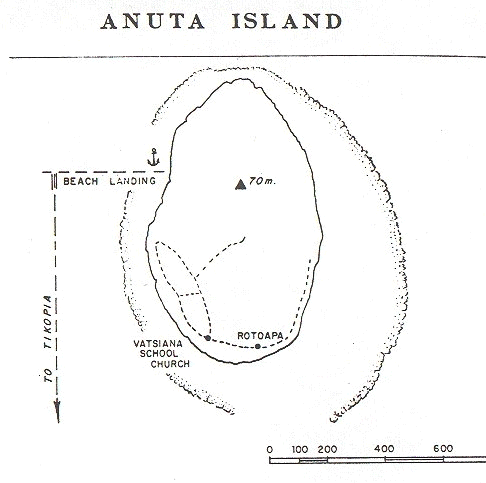 Title: Anuta Island |
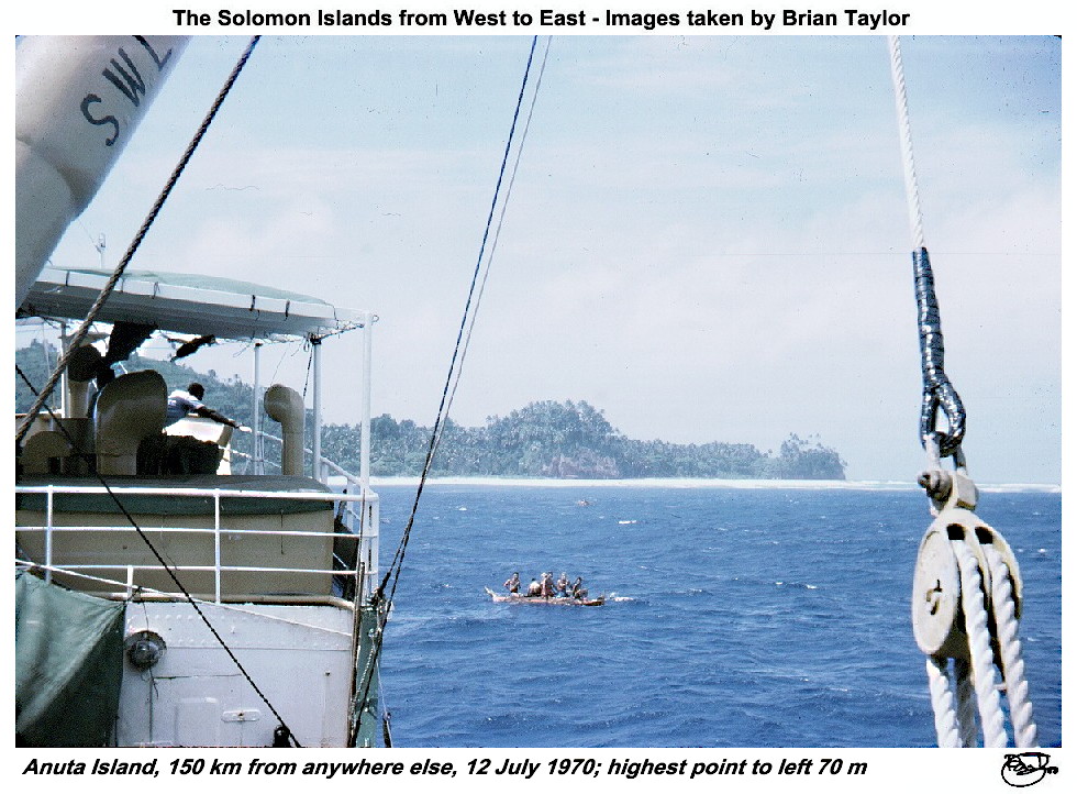 Title: Anuta Island, 150 km from anywhere else, 12 July 1970; highest point to left 70 m. |
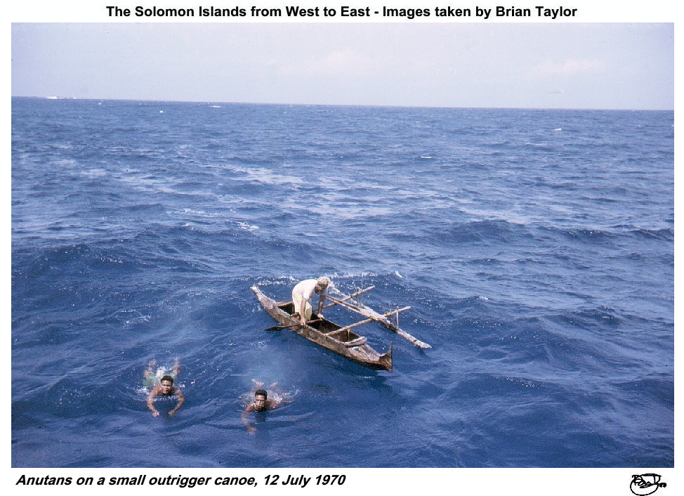 Title: Anutans on a small outrigger canoe, 12 July 1970 |
| Tikopia Although I visited Tikopia the weather and sea conditions were too difficult for photography - we had to wade ashore after disembarking from a dinghy into chest deep water. The island is small (5 km²) and of volcanic origin, rising to about 400 m. It is densely populated with (in 1970) 1040 Polynesians in several villages on the low-lying southwestern and southern flat areas. Gardens and coconuts extend high on the slopes. A freshwater crater lake, opening to the sea, occupies much of the eastern half of the island and is surrounded by swampy land. | 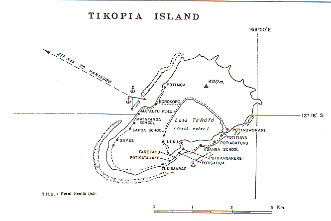 Title: Tikopia Island |
||
![]()
Title: Farewell to Honiara, dawn, July 1973
| |
|
| ©2000 - Brian
Taylor CBiol FIBiol FRES 11, Grazingfield, Wilford, Nottingham, NG11 7FN, U.K. Visiting Academic in the Department of Life Science, University of Nottingham |
Page 12 of 12