The Solomon Islands from West to East - The New Georgia Group
Images
taken by
Brian Taylor
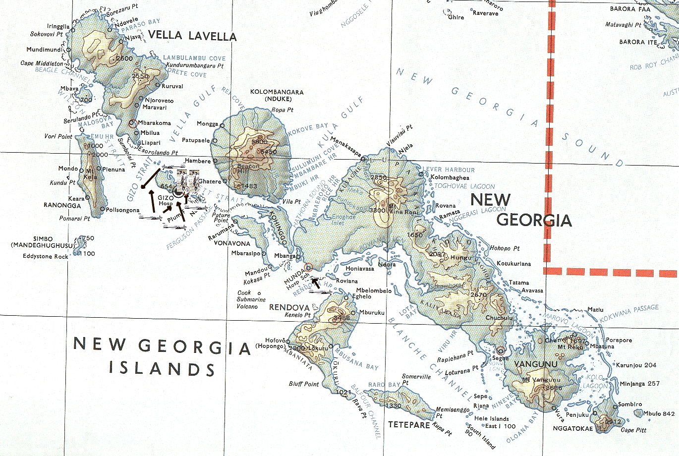
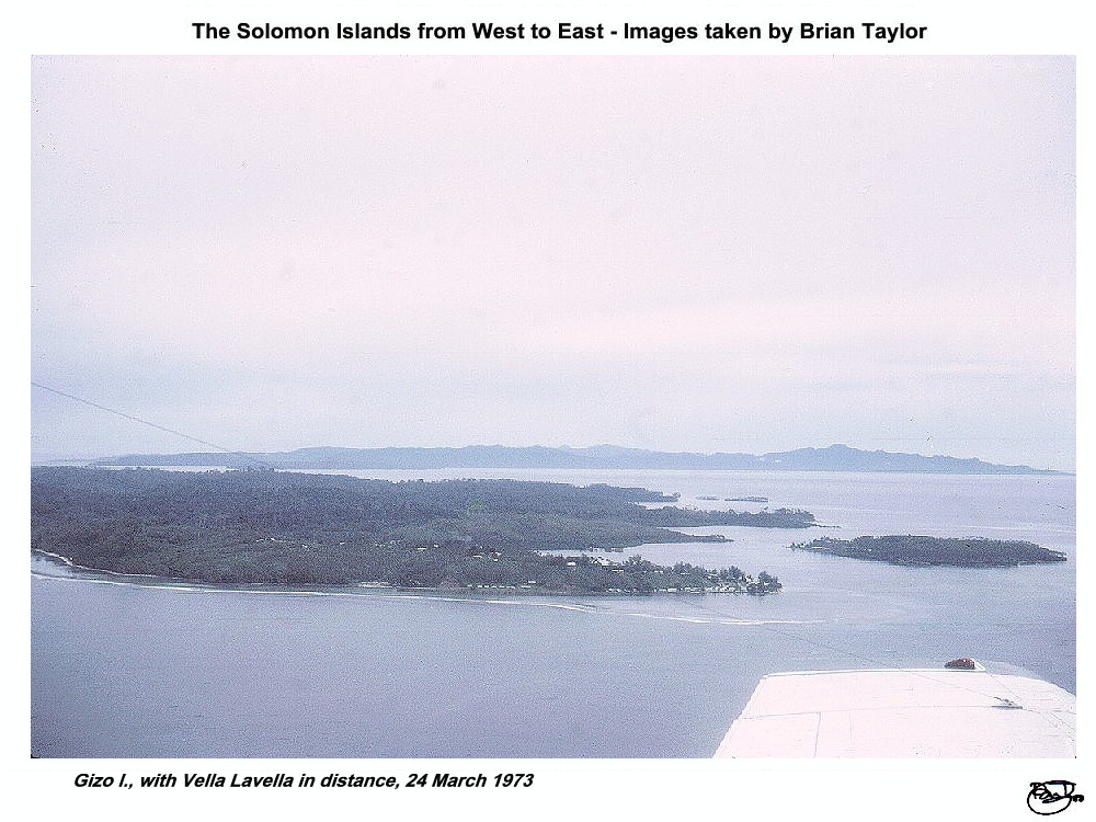
Vella Lavella is moderately large with a central massif rising
to 792 m. The island is some 33 km across from southeast to northwest and
25 km from northeast to southwest. In 1970, most people were living in the
southeast where the coastal shelf is widest. In the southern area there
were fairly extensive agricultural operations and a small airfield.
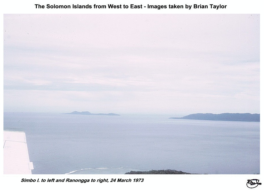
Ranongga is relatively small and narrow, running north to south
for about 30 km. A central ridge rises to 610 m. The people were living
all over the islands. I visited Buri in April 1971, remembering especially
the dolphins which escorted our small vessel into the bay.
Simbo is a small volcanic island with a dormant volcano,
fumaroles and hot springs. The maximum height is 335 m and the people
lived all over the island.
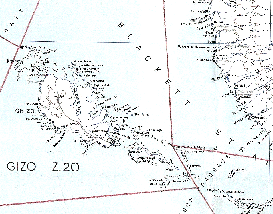
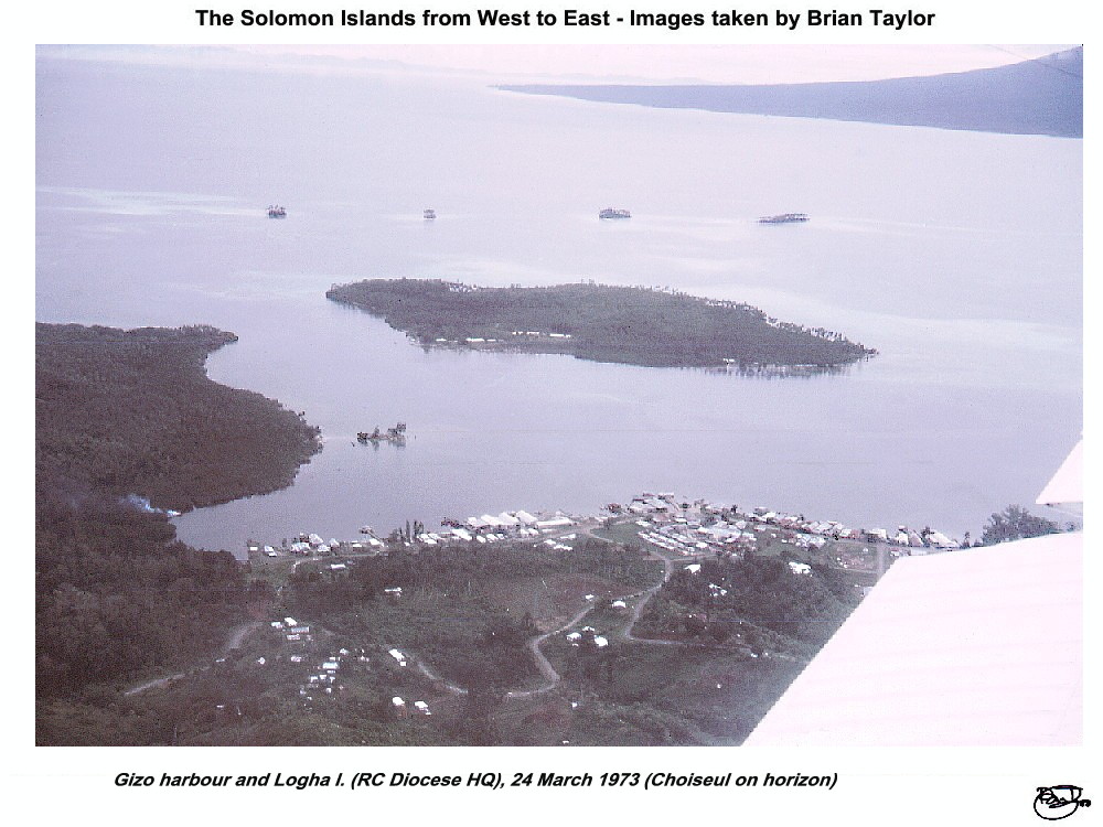
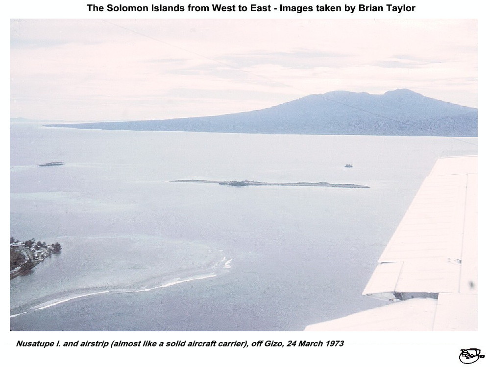
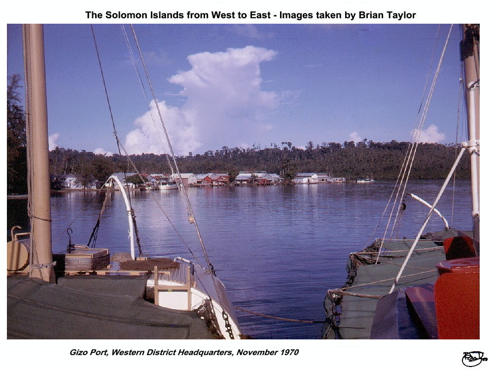
Gizo is a small island, rising to about 200 m, and the Gizo
town was the administrative centre for the Western District, with a port
which was visited by overseas vessels. The centre of the islands had been
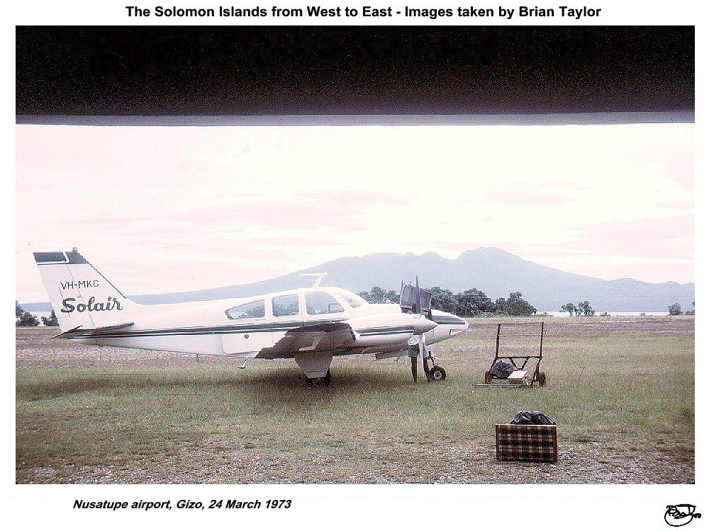
subjected to extensive forestry operations. A small airfield was built on
the narrow coral island of Nusatupe. I stayed in the town on several
occasions, including doing mosquito surveys and a control study in the
swamps around New Manda.
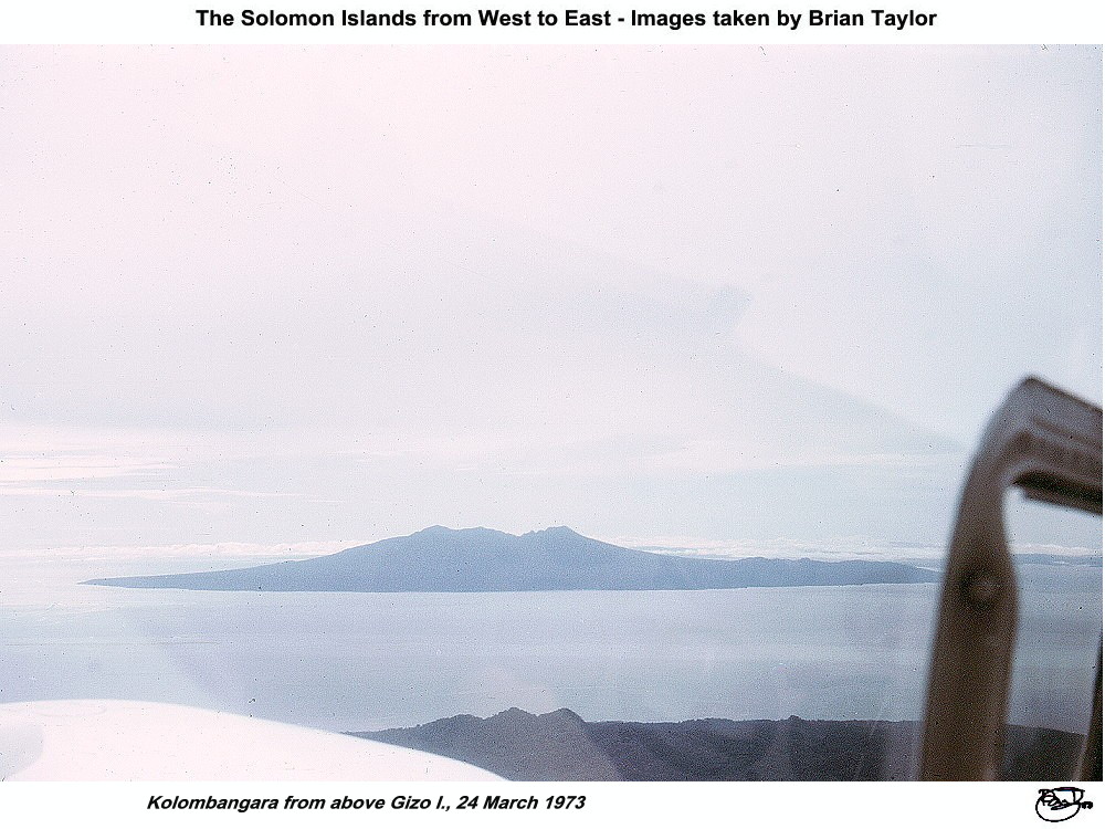
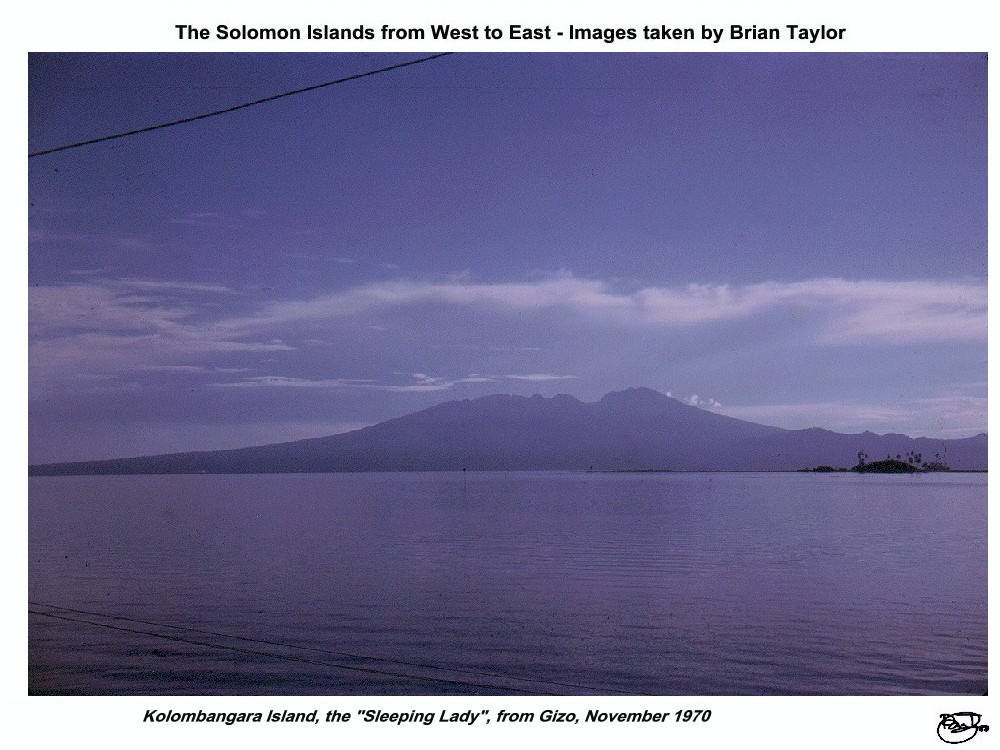
Kolombangara, the "sleeping lady", is a large single
extinct volcanic cone, rising to 1768 m at the crater rim. When active it
surely must have peaked at 3000 m or so, judging from the line of the
present slopes. All the inhabitants were living around the coast or in the
labour camps of the then extensive timber operations and coconut
plantations. There was a small airfield at Ringi Cove.
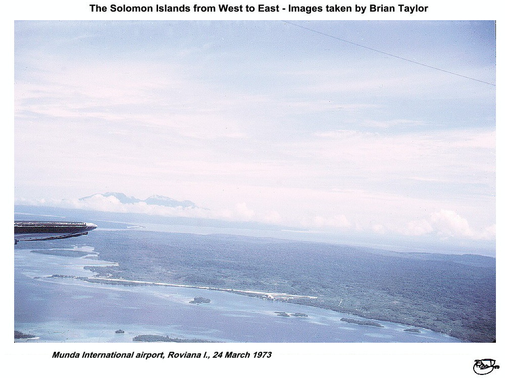
The New Georgia Group proper is a large group of islands running
northwest to southeast. The major islands are New Georgia, rising to 1006
m and 80 km long by 50 km at the wider western end; Vangunu, some 30 km in
diameter and rising to 1108 m; and Nggatokae, about 10 km in diameter,
with a high point of 888 m. Very extensive coastal lagoons stretch for
over 100 km off the eastern and northeastern coast (the Marovo Lagoon),
off the southern coast (Roviana Lagoon) and off the western extremity
(Wana Wana Lagoon which includes 2 fairly extensive flat coral islands,
Kohinggo (Arundel) and Wana Wana (Vona Vona). The lagoon coasts and
islands are the main population centres, although there was a United
Church Mission and Government Station around the international airfield at
Munda. Large scale timber operations were underway in the Kalivarana area
on southern New Georgia and these were expanding on to Vangunu. Coconut
plantations were found on many of the lagoon islands, but in the main the
coastal areas of the lagoons have extensive mangrove swamps. In April
1971, I was lucky to visit Munda, where the airfield was one of the major
Second World war battle areas, sailing from Gizo right down the southern
lagoons to the small airstrip at Seghe.
Rendova and Tetepare. Rendova is 30 km across from northeast to
southeast, and some 15 km wide, including the southern peninsula, it rises
to 1063 m. The inhabitants all lived near the coast and there were fairly
extensive coconut plantations. Tetepare, which is 25 km long and only 7 km
across with a high point of 405 m, was almost uninhabited except at the
western end where there was a coconut plantation.
|

Title: New Georgia Group |
|

Title: Gizo I., with Vella Lavella in distance, 24 March 1973
|

Title: Simbo I. to left and Ranongga to right, 24 March 1973
|

Title: Gizo Island and immediate surrounds |

Title: Gizo harbour and Logha I. (RC Diocese HQ), 24 March 1973
(Choiseul on horizon) |

Title: Nusatupe I. and airstrip (almost like a solid aircraft
carrier), off Gizo, 24 March 1973 |

Title: Nusatupe airport, Gizo, 24 March 1973 |

Title: Gizo Port, Western District Headquarters, November 1970
|

Title: Kolombangara from above Gizo I., 24 March 1973
|

Title: Kolombangara Island, the "Sleeping Lady", from
Gizo, November 1970 |
|

Title: Munda International airport, Roviana I., 24 March 1973
|
|

Location of photos from on-board ship |

Location of aerial photos |

Location of photos from on land |
©2000 - Brian
Taylor CBiol FIBiol FRES
11, Grazingfield, Wilford, Nottingham, NG11 7FN, U.K.
Visiting Academic in the Department of Life Science, University of
Nottingham
|
This page was created with ArcSoft Media
Browser 2000.
Page 4 of 12